MeteoMauritius.com - Weather in Mauritius, cyclones, satellite images
Meteo Mauritius - Weather in Mauritius
MeteoMauritius is an innovative website providing the latest weather report for the Island of Mauritius, found in the south-west Indian Ocean. Mauritius being very popular for tourist destination with its sea, sun and sand making it very unique on a paradise island. Mauritius is influenced by the South East trade wind resulting in weather conditions such as tropical cyclones amongst others. Being a tropical island, Mauritius has two main seasons which are summer and winter. Summer season occurs between the month of December till the month of April and winter occurs between the month of June to October. May is the transition month between summer to winter and November is the transition month between winter to summer. Weather in Mauritius is usually sunny throughout the year and the average minimum temperature is 18°C and maximum temperature 30°C. In winter, Mauritius is often affected by anticyclones which produces a slight decrease in temperature. Discover dedicated pages about tsunami in the Indian Ocean and Mauritius, weather photos, Mauritius beach weather, satellite images and animations, cyclones history, tropical cyclones tracking and weather in Rodrigues island.
Mauritius Weather Forecast
Meteo Mauritius weather forecast offers 9 districts regions where your nearest location can be easily found. Our service delivers 5 days forecast for nearly 100 locations in Mauritius along with weather map location. Weather data is updated instantly according to the weather change occurring in the Indian Ocean and Mauritius. A summarised description of some regions can also be found, making the visitors discover the island much better along with supported photos.
Mauritius satellite images - Indian Ocean
Satellite images have been of great importance in the background of weather prediction, whether to forecast forthcoming climate conditions till several days and even tracking cyclone trajectory. Under one roof, Meteo Mauritius delivers six Indian Ocean satellite images from color resolution, water vapour to infrared, showing Mauritius and its nearby islands, like Rodrigues, Reunion Island and Madagascar. The images gets updated from every 15 minutes to every 6 hours. Our satellite animation is updated every 6 hours.
Tropical Cyclones and tracking
Tropical cyclones in the South West Indian Ocean and Mauritius occurs in the summer season from the month of November till mid of May. However, the peak season for tropical cyclones in Mauritius is mid of February to the early month of March. Since the past, Mauritius has known most of the devastating cyclones during this peak period in the cyclonic history. Alix, Carol, Gervaise and Hollanda are well known in the island and Indian Ocean for their violent wind and making the island suffers from its primary sector at that time, which was the sugar cane plantation. However, each year the list of cyclone names changes and the names are given by the regional country in the Indian Ocean which are Mauritius, France (Réunion Island), Madagascar, Kenya, Tanzania, Mozambique, Malawi, Botswana, Lesotho, South Africa, Swaziland and Seychelles. MeteoMauritius offers cyclone tracking of the cyclones in the Indian Ocean and live cyclone warning for the Island of Mauritius provided by the Mauritius Meteorological Station. MeteoMauritius offers an exclusive weather photos gallery of past cyclones in Mauritius like Alix (January 1960), Carol (February 1960), Gervaise (February 1975) and amongst others.
Beach weather in Mauritius
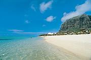
Famous for its beautiful beaches, fine white coral sand and turquoise water, Mauritius is nearly reaching 1 million tourist visitors annually. Tourists and Mauritians as usual, enjoy their holidays at the beaches across the island. The beach weather in Mauritius is becoming of great importance in order to enjoy the holidays at its maximum. MeteoMauritius has grouped all the major beautiful beaches of Mauritius like Mont Choisy, Pereybère, Trou aux Biches, Belle Mare, Blue Bay, Flic en Flac, Le Morne, Albion amongst others and delivering the weather forecast report.
Mauritius Tsunami - Indian Ocean
Tsunami has come to most people lips after the the significant earthquake of magnitude Mw 9.1-9.3 which occurred off the west coast of Sumatra, Indonesia on 26 December 2004. Mauritius has been among those countries that is directly affected by the tsunami waves in the Indian Ocean region. Our Mauritius tsunami page offers the explanation about what is a tsunami, how it occurs, the necessary precautions to be taken and we even offer live tsunami data whenever a tsunami is hit in the Indian Ocean.
Meteo Rodrigues
Situated in the Indian Ocean, about 650km off the north east of Mauritius, Rodrigues island had been directly dependent to Mauritius which later turn into autonomy. Rodrigues form parts of the Republic of Mauritius and it has a population of around 38,000 people. From years, this island has also been a destination for tourist coming on a visit to Mauritius due to its untouched nature, farming, fishing and geography. The weather in Rodrigues is affected same way as in Mauritius, with tropical cyclones and other weather conditions.
Follow MeteoMauritius
-
 : [}}} Facebook]
 -
 : @MeteoMauritius
 -
 : [}}} RSS Feed]
External Links
Categories:
- meteo
- Mauritius
- weather
- tropical cyclones
- indian ocean
- climate
- beach weather
- tsunami
- earthquake
- rodrigues
- photos
- satellite
- images
- animation
- tracking
- Cyclone Tracking
- Cyclone history
- Mauritius Beach weather
- Mauritius Meteo
- Mauritius Sun
- Mauritius Temperature
- Mauritius Weather
- Meteo
- Meteo Mauritius
- Meteo Rodrigues
- Pages with broken file links
- Rodrigues weather
- Tropical cyclones
- Weather
- Weather photos
- tsunami Mauritius


